Robot Monkeys

The monkeys know all.

Skip to content
  • Home
  • About

Population As Elevation

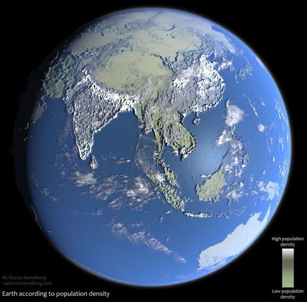
Marnix Hamelberg, created this visualization of the Earth’s population, where population density is mapped to elevation. It presents both a familiar and unfamiliar globe, as mountain ranges are still visible, but paradoxically as flat plains.

via CityLab

This entry was posted in illustration and tagged maps, marnixhamelberg, visualizations on November 26, 2017 by jonathan.

Post navigation

← Goodspeed Uncle Chuck CV Dazzle Updated →
  • animation / interactive / film
  • architecture / furniture
  • clothing
  • event
  • illustration
  • installation / sculpture
  • meta
  • other
  • packaging / stationary
  • personal
  • photo
  • street
  • tech

a/b apple augmentedreality berlin biology cabinets clothing coffeetables comics death deathwatch economics facebook fiction films games goldengatebridge google graffiti infrastructure lamps leds make maps military moffettfield mountainview music nasa plants politics qotd robots russia sanfrancisco security sex socialnetworks solar space television thefutureisnow userinterfaces video woodworking

Proudly powered by WordPress